Matlock is listed as Meslach in Domesday, probably meaning ‘the oak tree where the moot was held’ (moot being meeting).
Various other name variations where – Matlac in 1196, Matloc in 1204, Matelok in 1374.
It is the county town of Derbyshire and is situated at the south-eastern part of the Peak District, with the National Park directly to the west. The town is twinned with the French town of Eaubonne. It is a former spa town prospered from both the hydrotherapy industry and the cloth mills constructed on the River Derwent and its tributary Bentley Brook.
Thermal springs were discovered in 1698 and the population then increased rapidly in the 1800s, largely because of the popular hydros which were being built.
At one stage there were around twenty hydros, mostly at Matlock Bank, the largest built in 1853 by John Smedley. It closed in 1955 but re-opened in 1956 as the headquarters of the Derbyshire County Council. Matlock is also home to the Derbyshire Dales District Council as well as Matlock Town council.
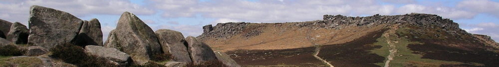
This geology of the area led to the expansion of quarrying and mining industries. Sandstones and gritstones quarried as building materials and the limestones for building materials and also the production of lime. the was much lead mining in the area and a very rare lead halide mineral called Matlockite was first discovered at nearby Bage Mine in the early 1800s, and is named after the town.
Access to Matlock was improved in 1818 when the road through Scarthin Nick near Cromford was blasted through.
Arrival of the railway in the 1870’s opened up Matlock and Matlock Bath even further.
At Park Head Road, overlooking Hall Leys Park in Matlock is a mock Tudor building. On the gable end of the wall facing the park is a painting of a black elephant. Original this was a relief with the name NAMUNAH on it. This relates to the time when the building was the premises of Burgon’s a high class grocery and provision store. Their Namunah trademark was the logo of an elephant.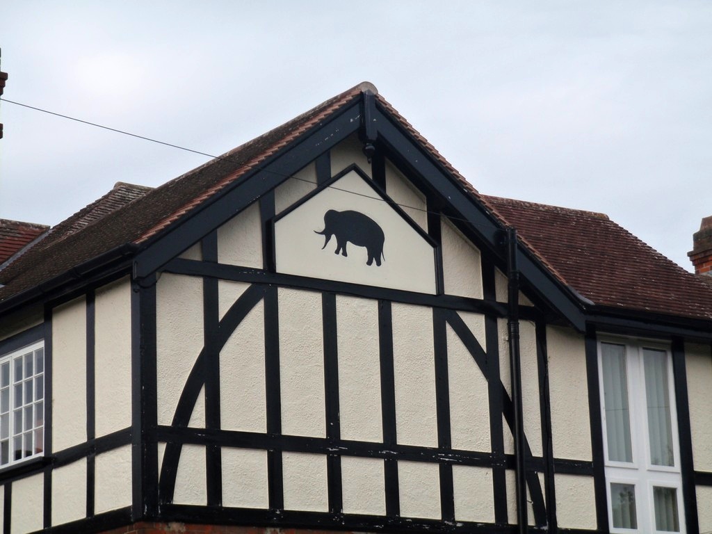
Crown Square at Matlock was the terminus of the Cable Tramway and the Tram Shelter. The cable tramway ran from Crown Square up Matlock Bank. The shelter was donated to the town by Robert Wildgoose in 1899. The central part of the shelter now stands in Hall Leys Park.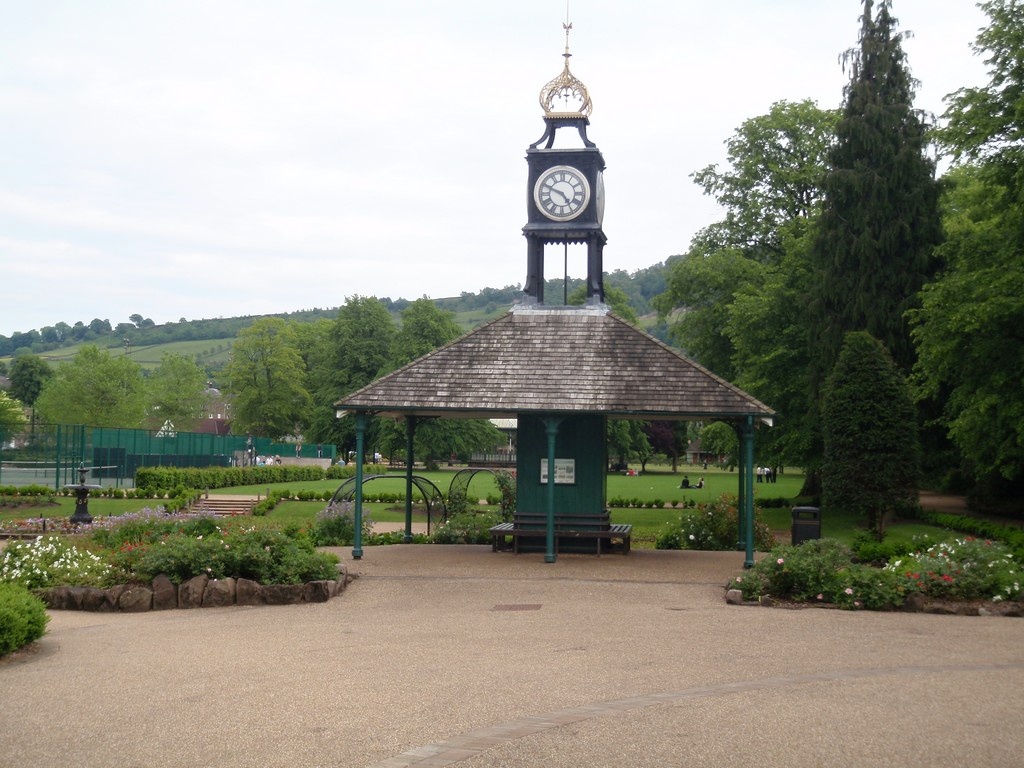
The engine house stood at the top of the hill on the corner of Rutland Street and Wellington Street. In 1890 John Smith of MAtlock suggested the idea of a cable tramway and a company was formed with George Newnes ( who founded the publishing company) mainly financing the venture. George Newnes was born at The Manse, Glenorchy Chapel in Cromford where his father was the minister. The tramway opened in 1893 and in 1898 he gave it to the Urban district Council. It finally closed in 1927.
The fare for the upward journey was double that for travelling down – it was 2d up and 1d down – this is the name of an informative book by M J Arkle entitled ‘Tuppence Up, Penny Down’. ‘The Matlock Steep-Gradient Tramway’ is a reprint of a 1893 publication which also gives a wealth of detail.
Hall Leys Park from Derbyshire Life –
Originally the area the park covers was known as Haw Lees. It consisted of two fields on the east bank of the River Derwent with a well-established footpath that linked Matlock Bridge with Matlock Green. In 1898 Matlock Urban Council acquired part of the land from Henry Knowles and the Broadwalk was formed along the route of the footpath. In 1908 the Council purchased the remainder of the two fields, including part that had been acting as Matlock’s football pitch, from Mr Perry of Manchester for a princely sum of £3,750. It appointed local architect John Nuttall to design a park and the official opening took place with due ceremony on 23rd June 1911, also celebrating the Coronation of King George V.
Ground Station Zero was a wartime wireless station located in Toplis’s tailoring workshop at 135 Smedley Street at Matlock. This was a covert Second World War wireless station code named ‘Operation Sea Lion’ operated by a specially trained civilian unit of volunteers.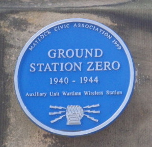 It was part of the secret wartime resistance set up to combat any invasion by German forces which was expected by the Government in the weeks following the evacuation of Dunkirk. This communications and intelligence command centre had the aerial hidden from view and its top-secret radio transmitter had a pistol, ammunition and hand grenade kept beside it at all times.
Fortunately the command centre was never required and the only indication of its existence is a blue plaque on the wall. The plaque was installed by the Matlock Civic Association in 1999 and the inscription reads – ‘GROUND STATION ZERO 1940-1944 Auxiliary Unit Wartime Wireless Station‘.
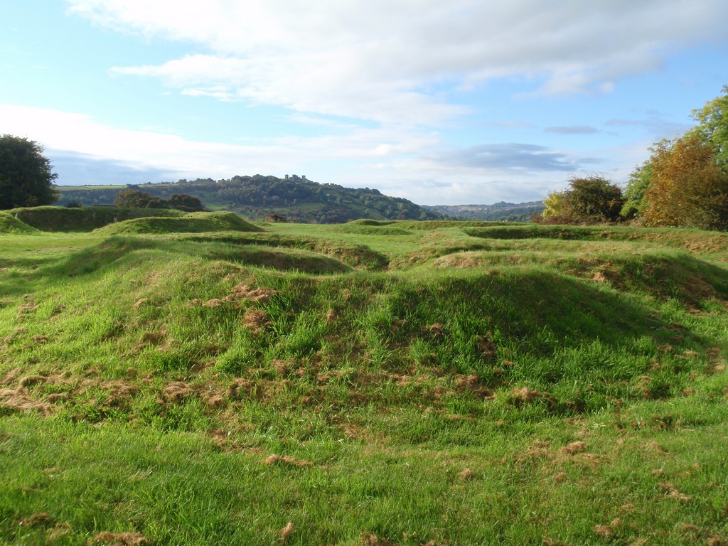
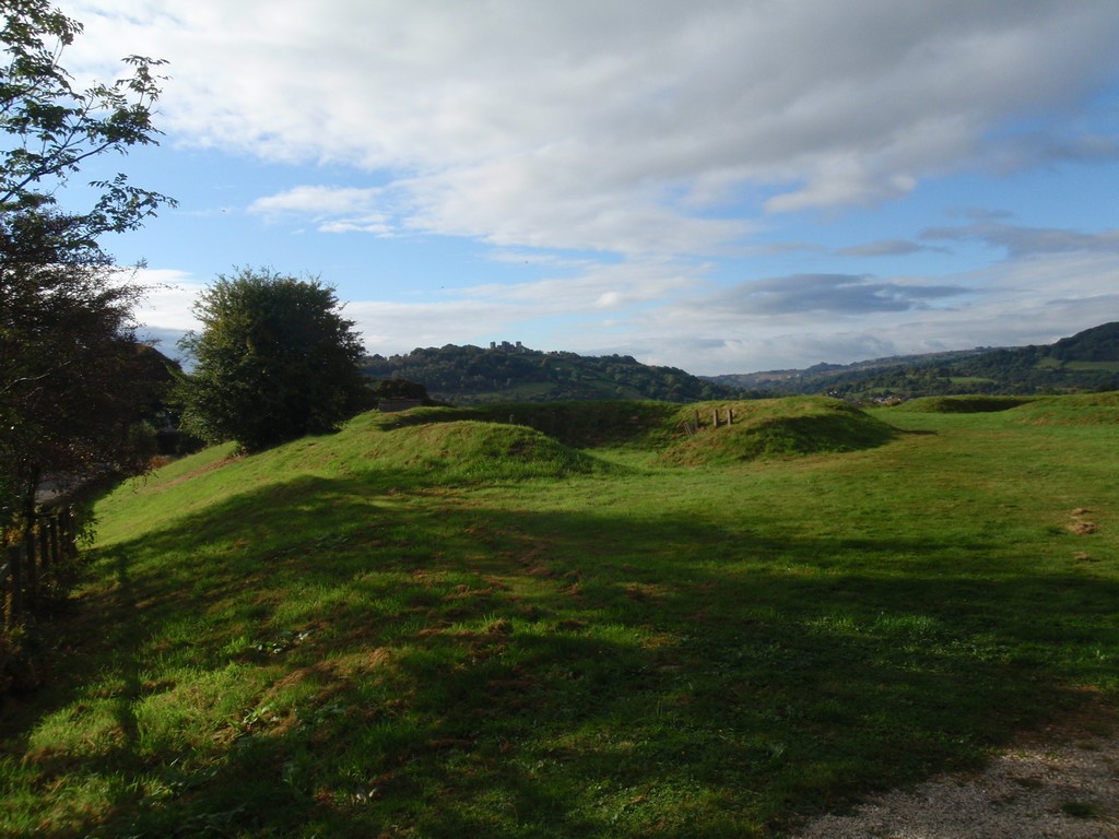
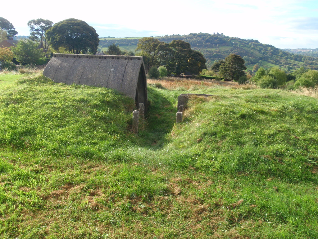
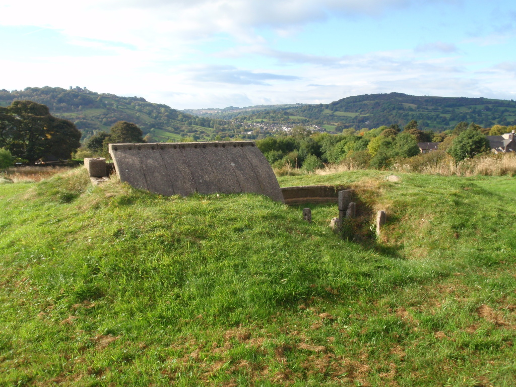
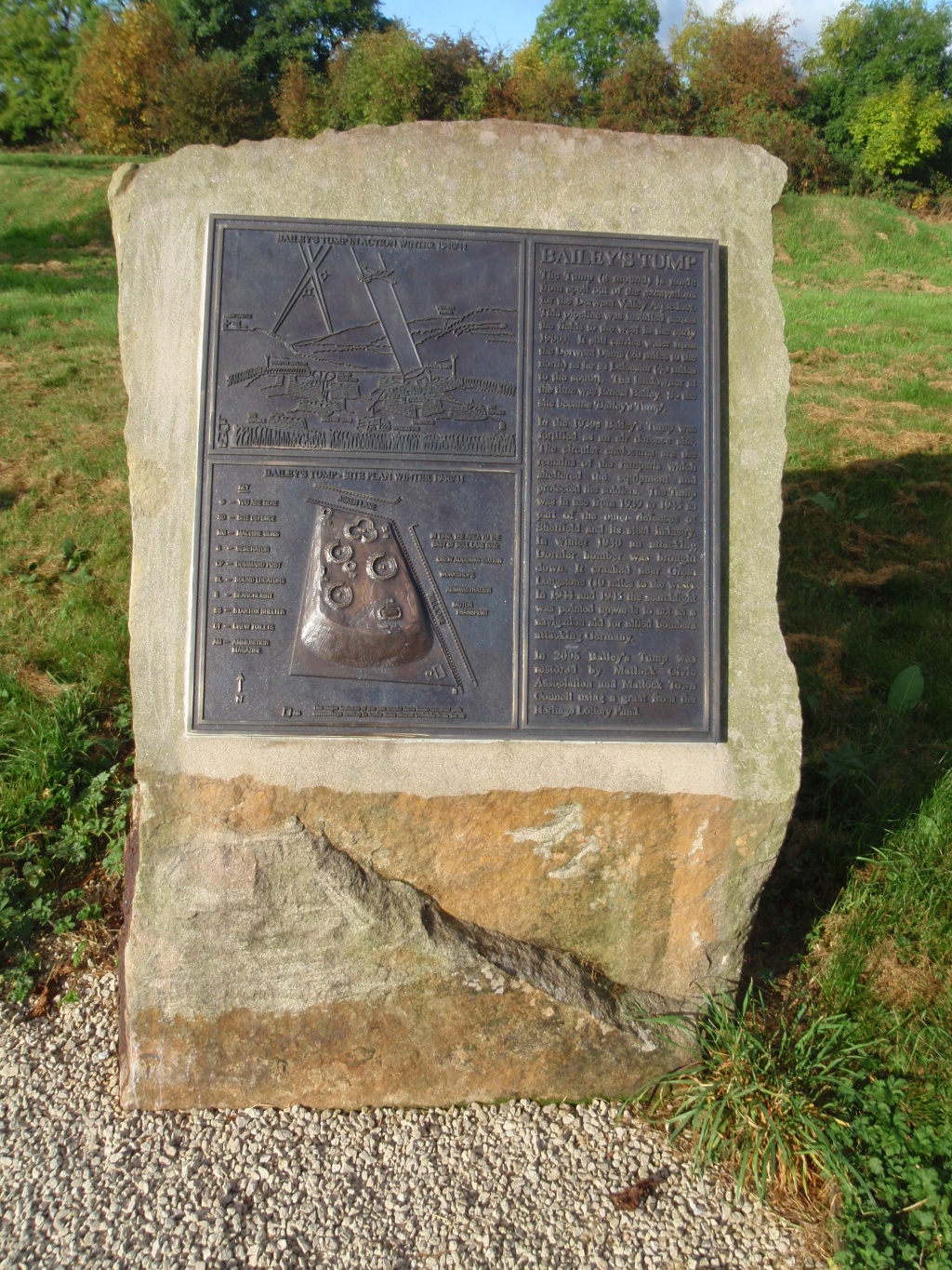
Bailey’s Tump
The Tump (a mound) at Asker Lane is made from spoil out of the excavations for the Derwent Valley Aqueduct.
This pipeline was installed across the fields to the west in the early 1900’s. It still carries water from the Derwent Dams (20 miles to the north) as far as Leicester (40 miles to the south). The landowner at the time was Ernest Bailey. So the site became ‘Bailey’s Tump’.
In the 1930’s Bailey’s Tump was fortified as an air defence site.
The circular enclosures are the remains of the ramparts which sheltered the equipment and protected the soldiers. The Tump was in use from 1939 to 1945 as part of the outer defences of Sheffield and its steel industry.
In Winter 1940 an attacking Dornier bomber was brought down. It crashed near Great Longstone (10 miles to the west).
In 1944 and 1945 the searchlight was pointed upwards to act as a navigation aid for allied bombers attacking Germany.
In 2005 Bailey’s Tump was restored by Matlock Civic Association and Matlock Town Council using a grant from the Heritage Lottery Fund.

The ancient Cuckoo Stone or cock crow stone, stands on the 11th fairway at Matlock golf club by the side of a hawthorn tree and is said to turn around at dawn on certain days of the year at the cock’s crow.
Not so far away is it thought that the famous lost stone circle The Seven Brideron (Bretheren) is said to have stood.
Bee Boles were a row of recesses, often in a south-facing garden wall. Each recess was big enough to hold a skep – the coiled-straw hive used by beekeepers in Britain before the introduction of the modern wooden hives in the late 19th century. An example of this could be seen near the ruins of Palethorpe farm to the North of Cuckoo Stone.