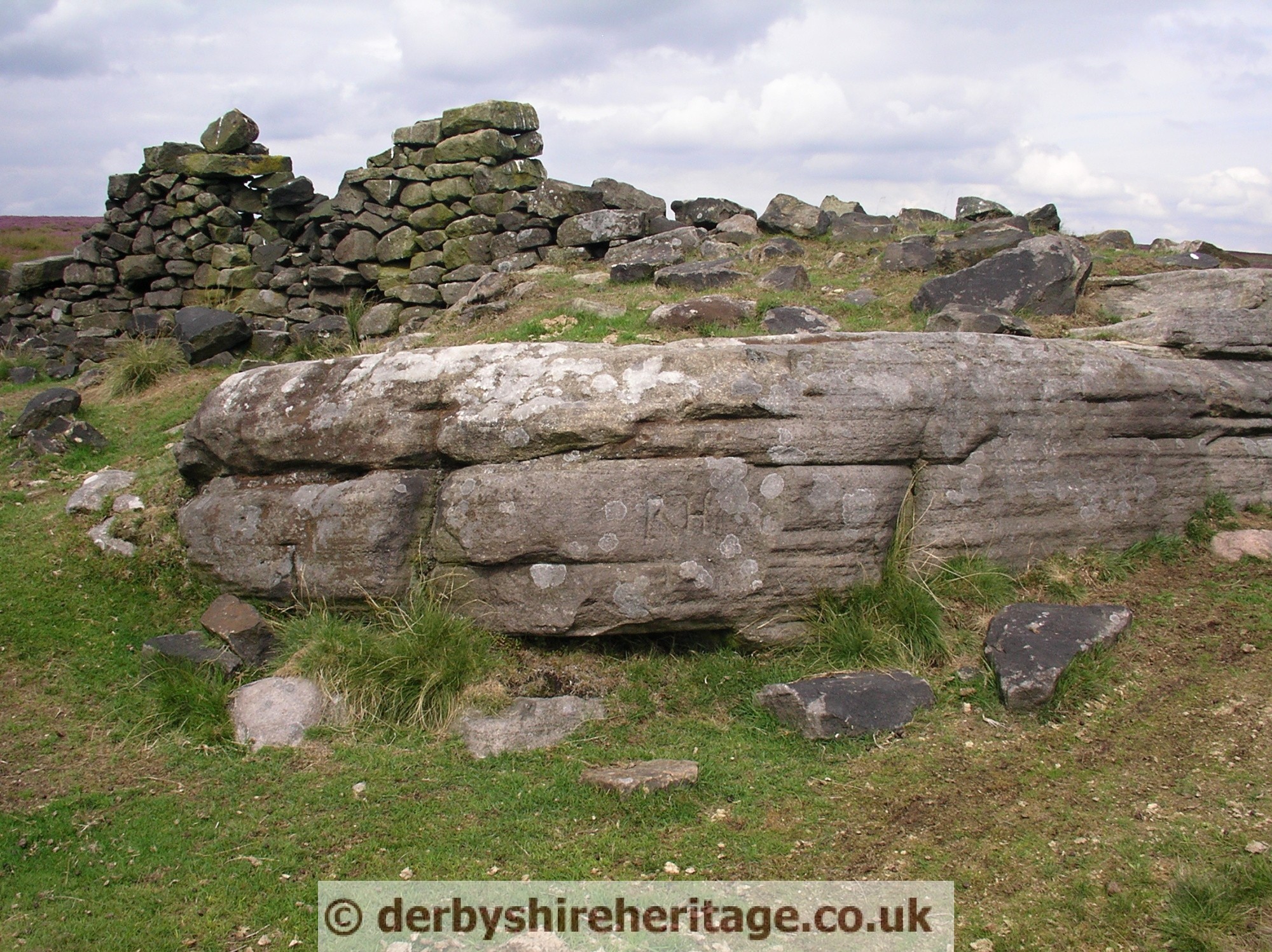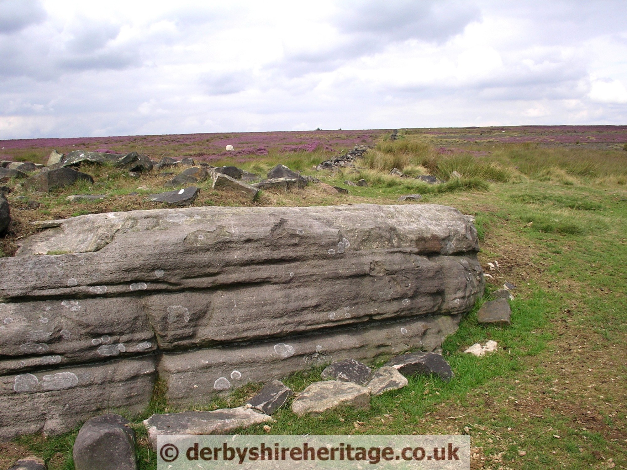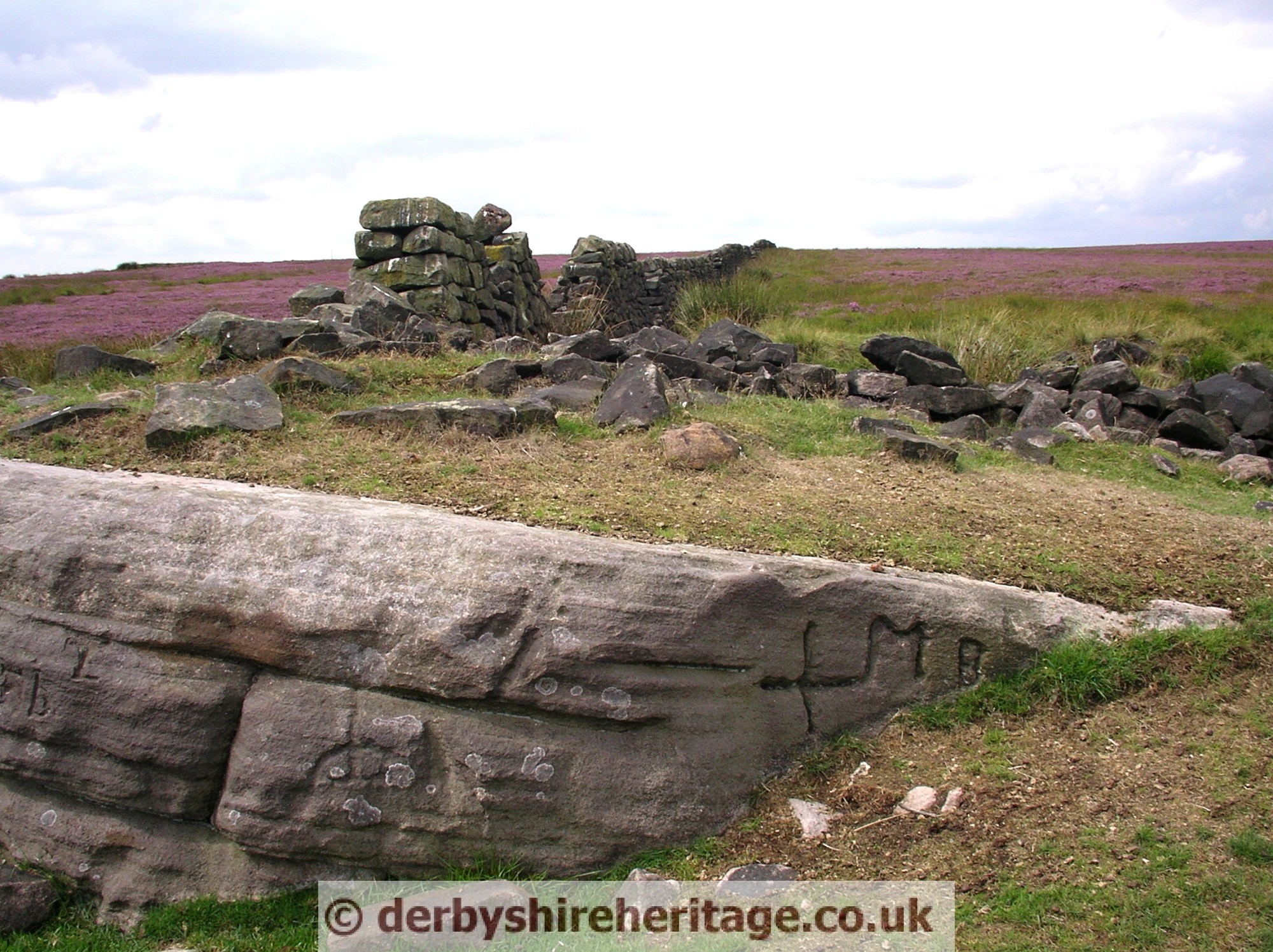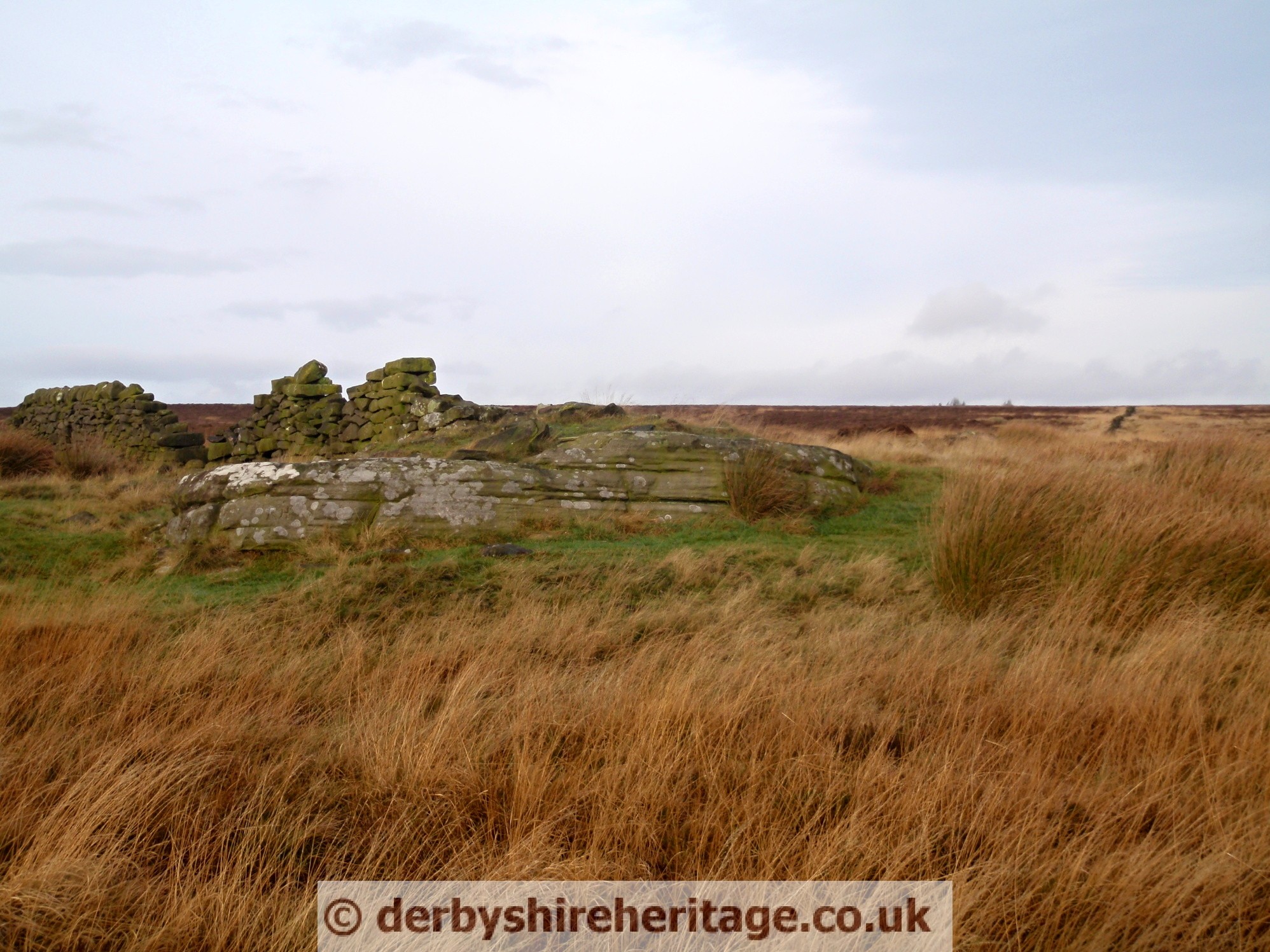
The Hurkling Stone stands at the junction of the present day parish and district boundaries, by two ancient walls. It is on White Edge moor south west of Lady’s cross.
‘Hurkling’ or ‘Herklin’ means to crouch and comes from the Old Norse language, the legacy of the Danish Viking settlement of this area.
This boundary of the Manors of Holmesfield, Padley and Baslow all met at this point and was once the meeting place of shepherds.
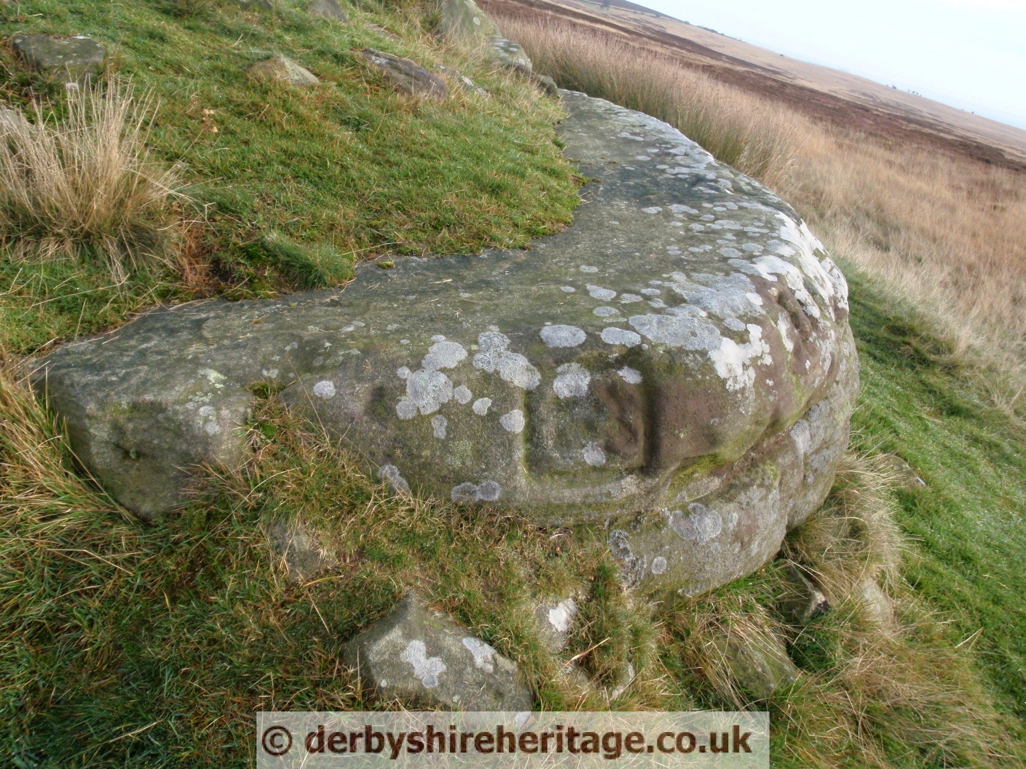
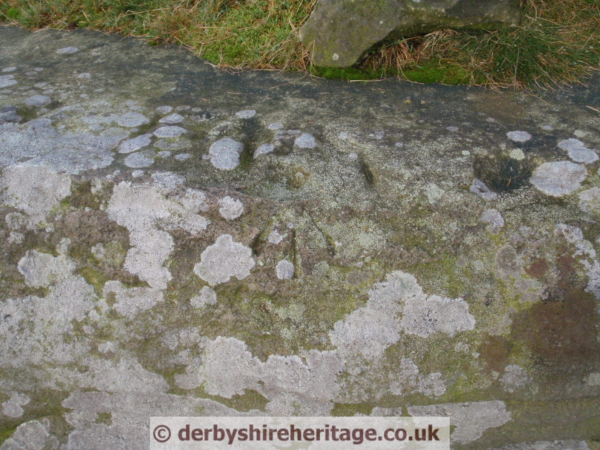
The most obvious mark is a small cross and the letters MB for Manor of Baslow. There is also an Ordnance Survey marker.
from Wishful Thinking website –
There is information on Perambulations of the Boundaries of Baslow 1614, 1626 and 1721.
Compiled by David Dalrymple-Smith, © Copyright January 2005
It used to be a tradition for the population of towns and villages to walk around the boundaries of their parish every decade or so. Records were kept and some have survived to the present day.
It is difficult to follow the routes of these but the Hurkling Stone is mentioned in three Perambulations.
The 1614 Perambulation is especially interesting in that it mentions the Hurkling Stone which marked on the OS map at White Edge Moor. The 1625 Perambulation mentions the hurkins Stone (sic). In 1721 the Herklin (sic) Stone, marked on the North end, xMB.